Each and every city has a story, full of unique challenges and environmental constraints shaping its present day image. Humans have been both clever, and daring enough, to conceive, design, and assemble infrastructure to surmount many of these otherwise barriers; or leverage them. The story of Cedar Falls and the Cedar River Watershed is no exception to such a project…
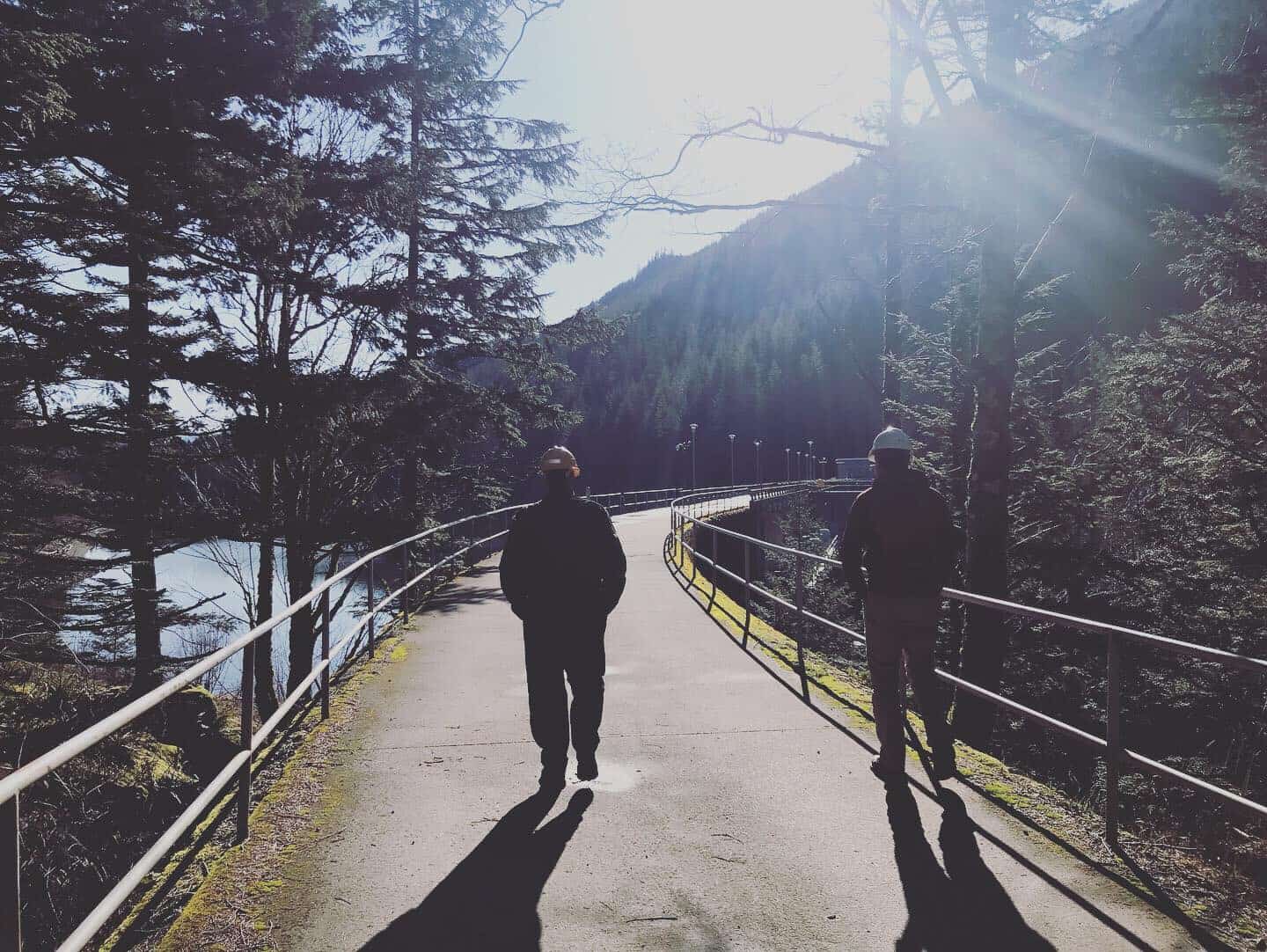
A group of hydro engineers were invited by Seattle City Light for a tour of this site, and its +100-year history. I tagged along to learn more about dams. Here is a glimpse into the past!
A Story with Roots…A Forest Full!
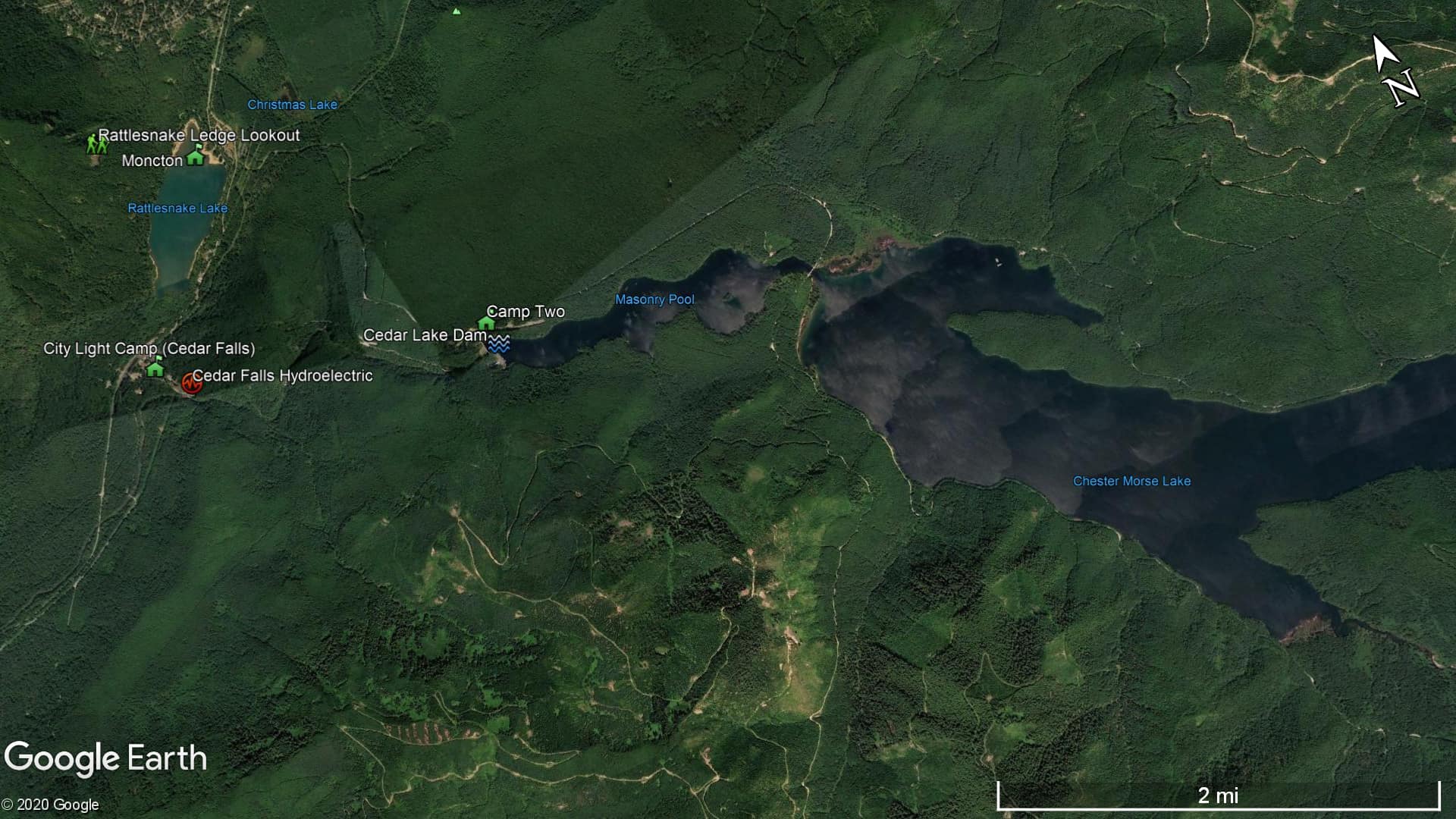
The history of the Cedar Falls watershed and surrounding forests is easiest seen from the popular Rattlesnake Ledge hiking trail. Whether it is new growth forests observed at the trails look-out, underwater remnants of Moncton, or roads to the old Work Camps comprising the town of Cedar Falls – this area holds a secret centuries in the making.
Let’s start with the location itself: approximately 91,400 acres of forested, mountainous terrain reaching heights of 5,500 feet along the eastern boundary of the Cascade Range. This dramatic landscape was the legacy of an ending ice age, retreating glaciers leaving behind beautiful Earth scars, rich soils, and Cedar Lake. First encountered by white settlers in the mid-to-late 1800’s (11,800’s Human Era), it is now believed that much of this lush forestland was relatively young, following massive high-elevation wildfires around 11,650-11,675HE. We also recognized that this region was not ‘discovered’ by settlers, who were looking for trade routes over the Cascades…It should be no surprise that this resource rich area was coveted by many tribes, long before the Cedar River became Seattle’s source for water, electricity, and logging operations stripped nearly 85% of the ‘old growth’ forest. Its use and occupation by indigenous peoples dates back thousands of years!
The City of Seattle – Here to Stay
As the populations rapidly grew throughout the 1890’s, an adequate source of water was needed to serve the city – 30 miles southeast was the Cedar River watershed. City engineer R.H. Thomson is credited for winning the support of officials and the public in 1899 to construct the river’s first dam, with a piping network to convey water to remote reservoirs and city residents. This project later evolved to include generating electricity (due to very steep rates) using a timber crib dam and powerhouse, started in 1902, completed in late 1904, with first electricity provided to Seattle in 1905!
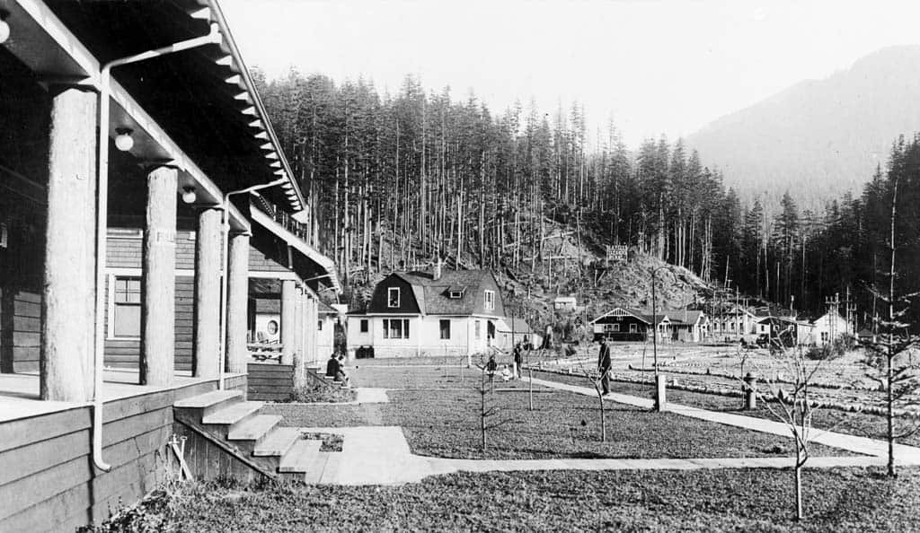
This 2,400-kW infrastructure asset came along with many stakeholders and the formation of new public utility structures. The price of timber alone pushed the City of Seattle to acquire much of the surrounding forest, and build their own sawmills. Work Camps were built to support the timber processing, rail transportation, dam construction, and operations of this novel project. Between 1900 to 1915, the once small homesteads grew rapidly into four distinct Work Camp communities along the upper Cedar River…
If you enjoy historical photos as much as I, check out the Snoqualmie Valley Historical Museum’s collection! Also, read more on HistoryLink.org – a great resource for Washington state curiosity…
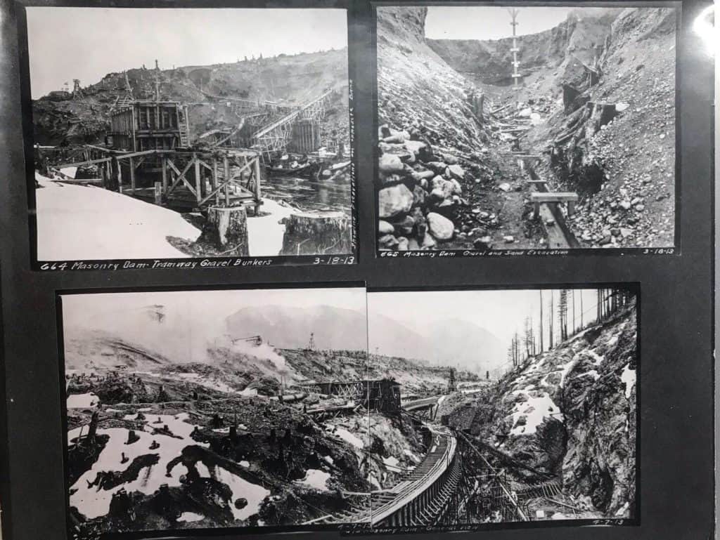
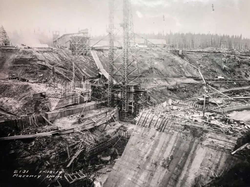
Electricity: The Thirst Grows!
Calls for a new source of electricity stemmed from Seattle Electric Company’s monopolized rates, limiting access to this novel technological wonder. Once online, the Cedar Falls crib dam supplied electricity through the city’s water department as the nation’s first municipally-owned hydro project; then in 1910, the newly-formed Seattle City Light took over as distributor. Within a year of the city’s powerhouse operation, rates from SEC, now know as Puget Sound Energy*, were reduced by half! Interestingly enough, lower rates were immediately met by higher demand and the small powerhouse capacity was exceeded. From 1906-1910, $2.8 million in bonds were approved to begin a much larger project.
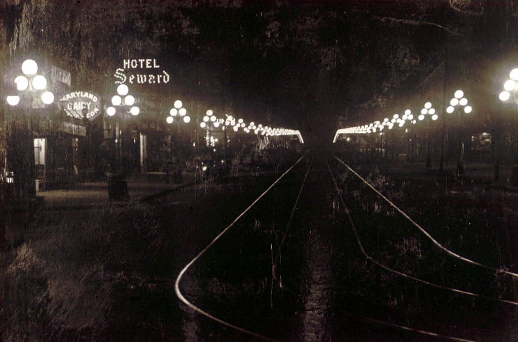
This project, a masonry dam which still operates today, was started in 1911 to provide up to 40,000-kW of electricity. Such a massive undertaking required a significant workforce, leading to the growth of work camps: a sawmill at Camp One for the initial dam project, City Light (Power Plant) Camp near the powerhouse, town of Moncton housing rail workers, and lastly Camp Two which facilitated the construction of new Cedar Falls Dam. Eventually, these communities were united under the name, Cedar Falls, and even had its own rail station.
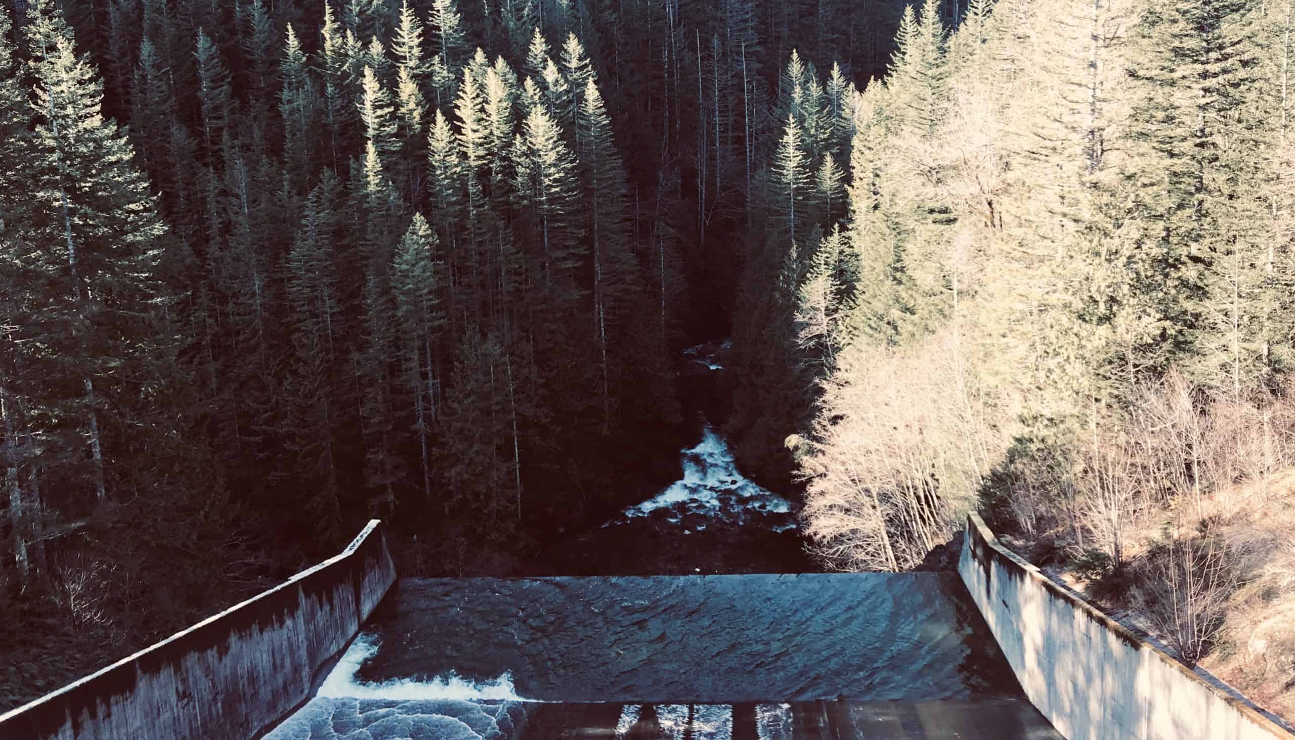
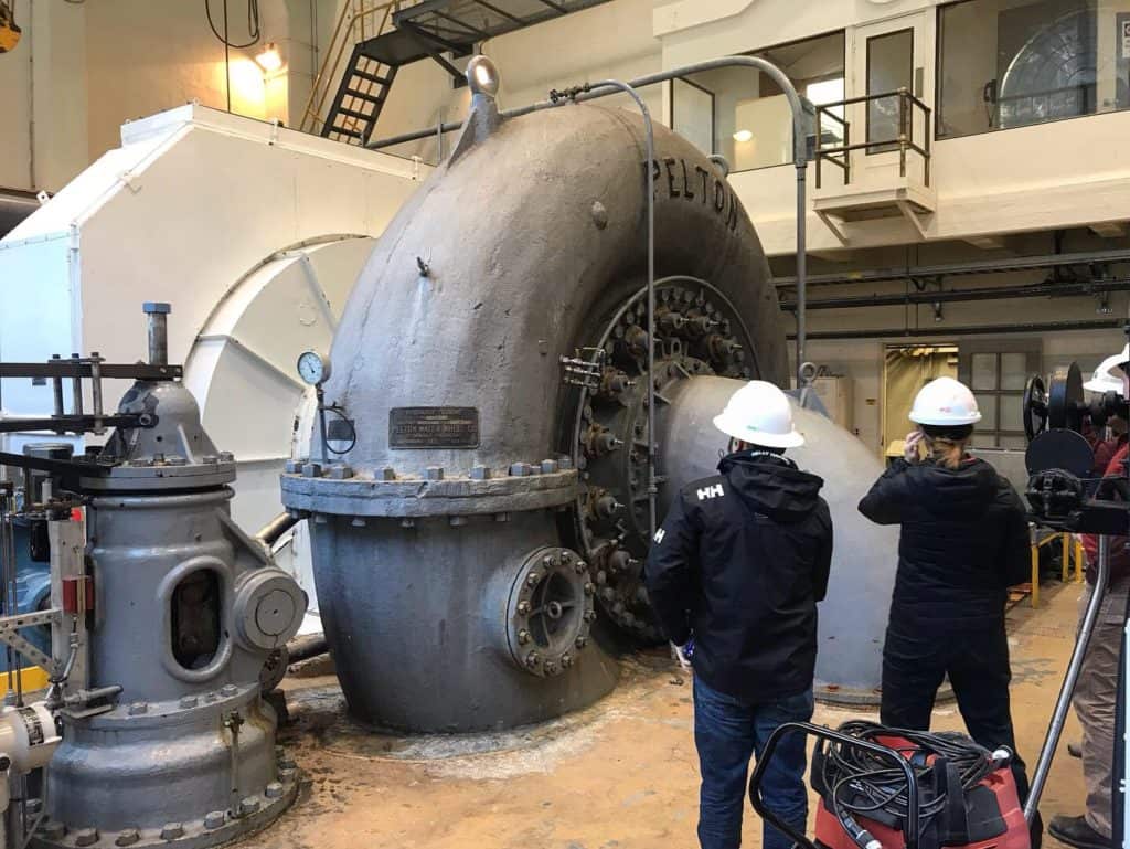
Completed in 1914, the impressive structure was designed to contain and harness the potential energy from Cedar Lake, renamed to Chester Morse Lake. The dam’s design included three pennstocks, two of which were built, to route water to the larger powerhouse. These 78-inch diameter pipelines travel over 1.5 miles along the Cedar River valley, with an effective head pressure of 620 feet delivered to two main water turbines, and two smaller units! However, the full design capacity of this new reservoir was only briefly realized.
*PSE was formed in 1997 when two of its largest ancestral companies – Puget Sound Power & Light Company and Washington Energy Company. The history does not end there, as ownership of PSE, along with many private utility companies is ever evolving…

A Reminder that Nature Remains Supreme
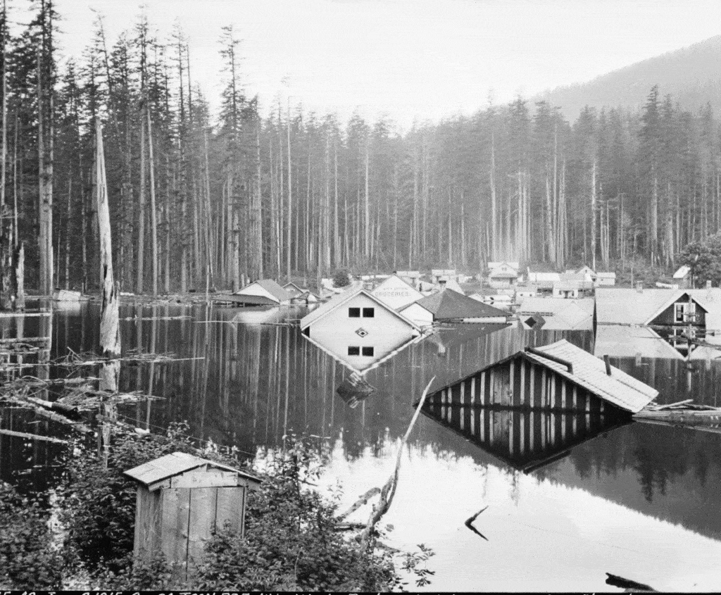
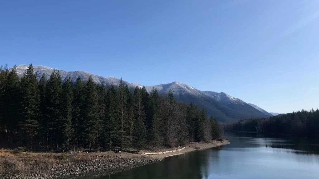
Moncton had developed into a relatively self-sufficient community on the north shore of present-day Rattlesnake Lake. But shortly after the dam’s completion, water levels rose not just at Chester Morse Lake, but also in this town. Before the end of 1915, Moncton was underwater and condemned. As it would turn out, a glacial moraine at higher elevation allowed water to slowly filter directly into the town’s peaceful valley. This phenomena had been previously observed throughout the Cascades; water flowing on-land, then disappearing into the ground. Such glacial moraines are the very reason Seattle’s many rivers are so naturally clean! Over the years, the Water Department engineered infrastructure to convey excess waters into lower river as to not flood the valley further, but nonetheless, the might of gravity remains a venerable force.
With the disappearance of Moncton, abandonment of Camp One, and the destruction of Camp Two by fire in 1922, most workers either moved to Power Plant Camp, now Cedar Falls, or to surrounding communities. Many workers had families by now, being that this region had a certain magnetism at the project heights. After all, there was a rail system to Seattle, a dirt road back to North Bend, and no shortage of summer and winter activities in the Cascades. However, this region also shared the consequences of its origins…
Many of the communities, built upon the bones of old growth forest, were often destroyed by wildfires, snow slides, and for the case of Edgewick, another glacial moraine failure in 1918, flooding the town completely. Cedar Falls remained a functioning community up until the 1940’s. When faced with a declining workforce, increased transportation access (commuting), and consolidation of schools to North Bend, Cedar Falls declined to day work use. The school closed, as did the swimming pool and stores. Visit now, and all which remains are a few preserved houses and the original street lamps…a vast departure of days past. Still worth a step back in time!
A Reminder that Nature Must Reign Supreme
There is no shortage of criticism through a lens reflecting history. Logging in the era of this project was anything but sustainable, damaging forests to such an extent that regrowth was dramatically hindered. Most trees seen today are only around 80-100 years old. Rapid clearing led to the displacement of indigenous peoples and native fauna, increased wildfires, and ecologically-destructive land erosion. The Cedar Falls project however, has helped shape a city which receives 86% of its power from hydro. What would the additional effects from burning coal equivalent look like? With such considerations, history remains fact and so do the effects of these projects…
What is most important is how we respond after observing anthropogenic impact and environmental degradation.
For Cedar River and Watershed, significant efforts have been made since 1924 to consolidate lands under the control of Seattle, restoring much of the 30,000 acres of removed forest. The City of Seattle, working with many non-profit organizations, has continually studied the effects of these projects to identify how to better operate and manage such assets. The operation of the dam and powerhouse is now restricted to ensure adequate and safe water supply to the Cedar River, helping to restore the ecosystem. 18% of the annual water flow from the watershed is used for drinking water.
Uncertain Futures, an all too familiar theme…
Even with regional programs to restore the watershed’s ecosystem and minimize the impact of the urban environment, there exists concern. Most notably, uncertainty surrounding how anthropogenic climate change is altering Washington’s many watersheds, and the infrastructure Humans have worked so hard to engineer and construct. With trends indicating a significant decline in snowpack and surface runoff, we may be faced with having to create another #InfrastructureIcon to accommodate our needs…
OR
We can instead begin to alter our needs and bad habits, to better accommodate a changing environment, and its many stakeholders…
Many thanks to Jessica at Seattle City Light for the amazing tour of Cedar Falls dam and powerhouse, opening my eyes to another legendary project! Be sure to Check out Seattle Public Utility’s official site, and visit the Cedar River Watershed Education Center!
Robert writes to share his experiences and observations through a lens of curiosity and questioning; why are so many places on Earth facing analogous challenges? how do we leverage nature’s regenerative mechanisms to craft more robust, equitable solutions? Utility² represents a big-picture vision in solving many shared challenges, by modernizing municipal utility services & infrastructure, while empowering community through engagement and cultural resilience in under-served, and developing regions.
